Building footprint
Outline of the existing building drawn to scale and located against visible site features.
Building footprint, exterior context, and visible site features captured to permit-ready scale. Issued in DWG and PDF, ready for design, planning, or municipal review.
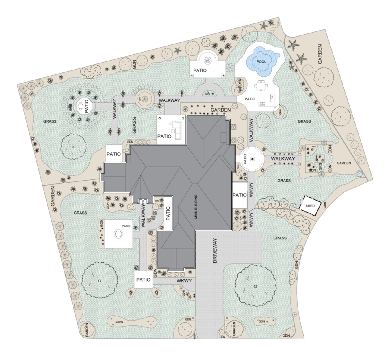
Site plans show the building footprint and the visible exterior features that surround it: driveways, walkways, patios, decks, landscape areas, parking, and visible easements or boundary markers where applicable. Issued in DWG and PDF so your design and consultant team can take it straight into their workflow.
Outline of the existing building drawn to scale and located against visible site features.
Paved areas, walkways, and access points captured at their visible edges.
Visible parking layout including stalls, drive aisles, and accessible spaces where applicable.
Visible planting beds, lawn areas, mature trees, and hard-surface zones noted on plan.
Properly oriented drawing with a measured scale bar suitable for permit submissions.
Indicative dimensions from the building to visible boundaries where they can be reliably measured.
Note: Site plans are based on visible, measurable site features. Where legal boundaries, official setbacks, or grading information are required, an Ontario Land Surveyor's plan or an engineer's drawing should be used.
Send us the property details: address, scope, and any drawings you already have. We'll come back with scope and pricing.